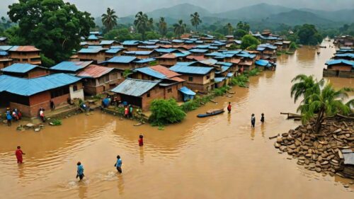
Understanding Nepal Floods: Causes, Impact, and Preparedness
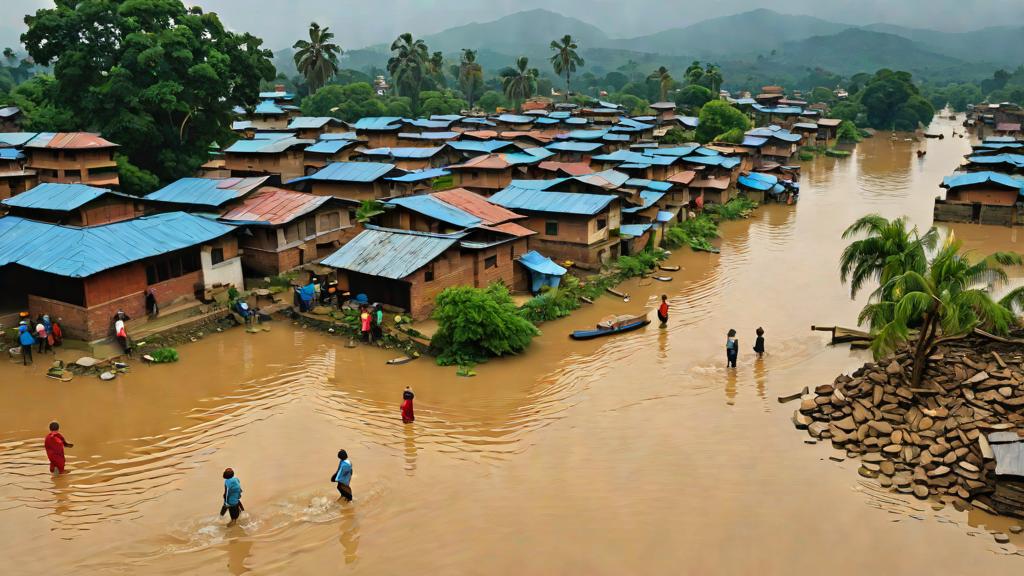
- Nepal floods mainly occur during the monsoon (June‑September) due to heavy rain, glacial melt, and river overflow.
- Historical data shows major flood events every 3‑5 years, with the 2017 and 2020 floods each causing over 140 deaths.
- The Terai plain and Kathmandu Valley are the most vulnerable areas because of low elevation and dense settlements.
- Climate change is projected to increase monsoon intensity by up to 15%, raising future flood risk.
- Early warning systems, reinforced embankments, and community drills are essential for reducing flood damage.
Nepal floods are seasonal flooding events that occur primarily during the monsoon months of June to September, caused by intense rainfall, glacial melt, and river overflow. They affect low‑lying valleys and the Terai plain, leading to displacement, infrastructure damage, and loss of life.
What causes floods in Nepal?
Three main natural processes drive the frequency and severity of Nepal floods:
- Monsoon rains: The South Asian monsoon delivers 70‑80% of annual precipitation between June and September, often in short, heavy bursts that exceed river capacity.
- Glacial and snow melt: Rapid melting of Himalayan glaciers during warm spells adds volume to downstream rivers, especially the Koshi, Gandaki, and Karnali basins.
- Riverbank erosion and landslides: Steep terrain and deforestation increase sediment load, narrowing river channels and raising the likelihood of overflow.
Human factors such as unplanned urban expansion, inadequate drainage, and encroachment on floodplains amplify the impact.
How often do major floods occur in Nepal?
Historical records show that significant flood events recur roughly every 3–5 years, often coinciding with strong monsoon seasons. Notable recent floods include:
| Year | Fatalities | Affected Districts |
|---|---|---|
| 2017 | ~150 | Koshi, Sunsari, Morang |
| 2018 | ~25 | Rautahat, Bara, Sarlahi |
| 2020 | ~140 | Koshi, Sindhuli, Dhading |
| 2021 | ~30 | Mahottari, Dhanusha, Siraha |
These figures come from Nepal’s Department of Water Resources and the National Disaster Risk Reduction Authority, which track casualties and damage assessments.
Why are the Terai and Kathmandu Valley especially vulnerable?
The Terai, a flat lowland bordering India, contains dense agricultural settlements and major transportation corridors. River systems such as the Koshi, one of the world’s most sediment‑laden rivers, regularly breach banks during peak flow.
In contrast, the Kathmandu Valley sits on a bowl‑shaped basin surrounded by hills. Heavy rains quickly saturate soil, leading to flash floods in tributaries like the Bagmati and rapid landslides that block drainage.
What are the economic and social impacts of Nepal floods?
Floods cause multi‑dimensional losses:
- Agriculture: Approximately 30% of Nepal’s rice‑producing area lies in flood‑prone districts; a single severe flood can destroy up to 40% of a season’s harvest.
- Infrastructure: Roads, bridges, and power lines are regularly washed away, increasing repair costs by an estimated US$50 million per major event.
- Health: Stagnant water fosters water‑borne diseases; cholera and diarrheal outbreaks rise by 20‑30% in the weeks after flooding.
- Displacement: The 2020 floods forced over 250,000 people into temporary shelters, straining humanitarian response capacities.
How does climate change influence Nepal’s flood risk?
Climate models predict a 10‑15% increase in monsoon rainfall intensity by 2050. Warmer temperatures accelerate glacial melt, contributing additional river discharge during the critical monsoon window. These trends suggest that flood frequency and magnitude will rise, making adaptation a priority for policymakers.
What preparedness measures can reduce flood damage?
Effective flood risk reduction combines structural and community‑based actions:
- Early warning systems: Nepal’s Department of Hydrology operates river‑level gauges that trigger alerts via SMS and radio.
- Riverbank reinforcement: Engineered embankments and riparian vegetation help stabilize banks and reduce overflow.
- Land‑use planning: Zoning laws that restrict construction on known floodplains limit exposure.
- Community drills: Regular evacuation drills in schools and local councils improve response speed.
- Resilient housing: Elevating homes on stilts and using flood‑resistant materials reduces structural loss.
Can international aid help mitigate Nepal floods?
International partners, including the United Nations Development Programme (UNDP) and the Asian Development Bank (ADB), fund flood‑risk infrastructure, climate‑resilient agriculture, and capacity‑building programs. Collaboration with neighboring India on transboundary river management also plays a crucial role, as the Koshi River’s catchment extends across the border.
Where can I find real‑time flood information for Nepal?
Reliable sources for up‑to‑date flood data include:
- The Nepal Department of Hydrology website (hydrology.gov.np) – live river‑stage charts.
- The International Centre for Integrated Mountain Development (ICIMOD) – seasonal flood forecasts.
- Mobile apps such as “My Nepal Disaster” – push notifications for alerts.
What steps should tourists take during the monsoon season?
Travelers planning to visit Nepal between June and September should:
- Monitor weather forecasts daily.
- Avoid low‑lying routes near the Koshi and Bagmati rivers during heavy rain.
- Carry waterproof bags for electronics and important documents.
- Register with their embassy’s emergency contact system.
- Follow local authorities’ guidance on road closures or evacuation orders.
By staying informed and respecting local advisories, tourists can enjoy Nepal’s natural beauty while minimizing risk.
Long‑term adaptation and policy initiatives
Beyond immediate response, Nepal is formulating a national flood‑risk management framework that aligns with the Sendai Disaster Risk Reduction Goals. Key policy pillars include:
- Integrated watershed management: Multi‑sectoral committees coordinate reforestation, terracing, and controlled grazing to reduce upstream runoff.
- Climate‑smart agriculture: Promotion of flood‑tolerant rice varieties and raised‑bed farming minimizes crop loss while preserving soil health.
- Insurance schemes: The government‑backed “Agricultural Weather Index Insurance” offers payouts based on rainfall thresholds, providing a safety net for smallholder farmers.
- Transboundary cooperation: Joint flood‑forecasting centers with India share real‑time hydrological data for the Koshi and Gandaki basins, enabling coordinated dam releases and early warnings.
Case study: 2023 Koshi flash flood
In August 2023, an unprecedented cloudburst in the eastern Himalayas caused the Koshi River to surge 3.2 m above normal levels within 12 hours. The rapid rise overwhelmed embankments in Sunsari and Morang districts, inundating 45 km of highway and displacing 18,000 residents. Prompt activation of the Department of Hydrology’s SMS alert system allowed over 70 % of households in the most vulnerable villages to evacuate to higher ground, reducing the death toll to 12 compared with projected estimates of 50‑60. Post‑event analyses highlighted the critical role of community‑led river‑bank monitoring groups, which reported rising water levels 30 minutes before official gauges registered the peak.
Emerging technologies for flood resilience
Remote‑sensing satellites, such as the Indian RISAT‑2B, now deliver sub‑kilometer precipitation estimates every three hours, feeding into AI‑driven flood‑prediction models that forecast river discharge with 85 % accuracy up to five days ahead. Mobile‑based crowd‑mapping platforms let volunteers upload photos of breached levees, allowing rapid deployment of repair crews. These digital tools are increasingly integrated into Nepal’s disaster‑management operating procedures, enhancing both situational awareness and resource allocation.
Frequently Asked Questions
How many people are typically displaced by a major flood in Nepal?
A large flood can displace between 100,000 and 300,000 residents; the 2020 event forced over 250,000 people into temporary shelters.
What is the most flood‑prone river in Nepal?
The Koshi River, known as the "Sorrow of Bihar," is the most flood‑prone due to its huge sediment load and wide basin that spans both Nepal and India.
Are there any low‑cost actions individuals can take to protect their homes?
Elevating furniture, using sandbags around doorways, and storing valuables in waterproof containers are inexpensive steps that reduce water damage during floods.
Does Nepal have a national flood early warning system?
Yes, the Department of Hydrology operates a network of river‑level gauges that issue SMS and radio alerts when water levels approach danger thresholds.
Will tourism be affected by monsoon floods?
Tourism can be impacted by road closures and landslides, but most major trekking routes remain open; visitors should stay updated on local weather and follow safety advisories.
About The Author