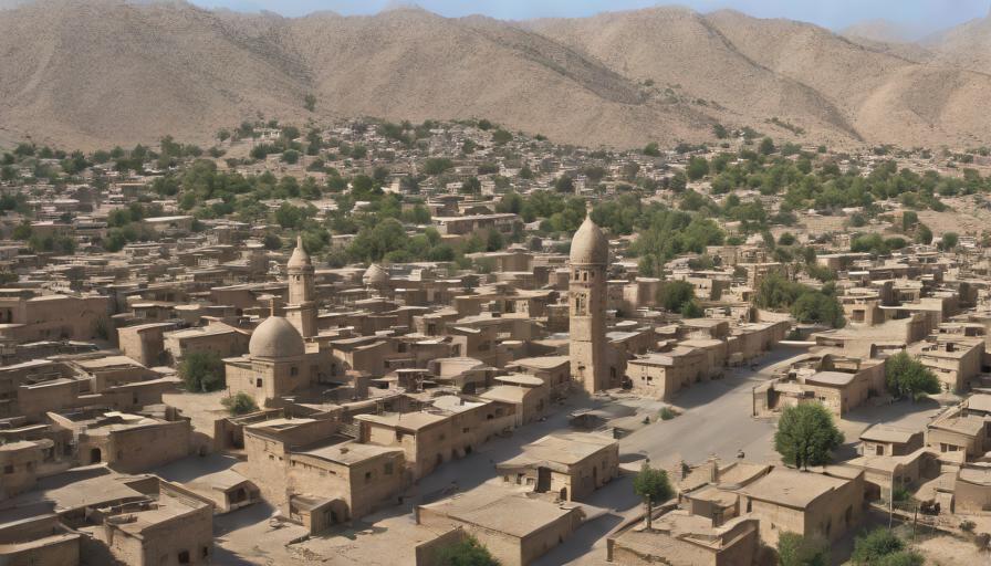
- Kohat is a historic city in Khyber Pakhtunkhwa, Pakistan, located 180 km south‑west of Islamabad.
- The Karran Oilfield, discovered in 1958, makes Kohat a key contributor to Pakistan’s oil production.
- Kohat’s climate is semi‑arid with hot summers, mild winters, and most rain falling during the monsoon.
- Major attractions include Kohat Fort, Kohat Pass, Shah Mansur Mosque and the seasonal Thal Jheel.
- The University of Science and Technology, Kohat (USTK) offers engineering and IT programs to over 5,000 students.
Kohat is a city in the Khyber Pakhtunkhwa province of Pakistan, located about 180 km south‑west of Islamabad. It serves as the administrative centre of Kohat District and is known for its historic forts, oil fields, and the Kohat Pass linking the city to the tribal areas.
Where is Kohat located and what are its geographic features?
Kohat lies at latitude 33.58°N and longitude 71.45°E, at an elevation of roughly 460 metres (1,510 ft) above sea level. The city sits on the banks of the Kohat River, a tributary of the Indus, and is surrounded by the Khattak hills to the north and the Karak range to the south. Its strategic position on the historic Grand Trunk Road makes it a gateway between the Peshawar valley and the central plains of Pakistan.
What is the historical background of Kohan?
The region has been inhabited since the Mauryan era (3rd century BC), but the modern city of Kohat emerged under the rule of the Sikh Empire in the early 19th century. The British annexed the area in 1849, establishing the Kohat Cantonment and building the iconic Kohat Fort in 1849‑1850. During the 1947 Partition, Kohat became part of the newly formed Pakistan, and its population grew from about 45,000 in 1951 to over 600,000 by the 2023 census.
How does Kohat’s economy contribute to the region?
The local economy is a blend of agriculture, energy production and small‑scale manufacturing. Major crops include wheat, maize and sugarcane, cultivated on roughly 150,000 hectares of arable land. Kohat is home to Pakistan’s first commercial oil field, the Karran Oilfield, discovered in 1958 and producing an average of 6,500 barrels per day as of 2022. The city also hosts a growing textile cluster, employing over 12,000 workers across 45 factories.
Key economic sectors
- Oil and gas extraction – Karran and Bannu fields.
- Agriculture – wheat, maize, sugarcane, and horticulture.
- Textiles – cotton yarn, knitwear, and ready‑made garments.
- Retail and services – bazaars, hospitals, and education centers.
What are the main attractions for visitors to Kohat?
Kohat offers a mix of natural scenery and cultural heritage. The most visited sites include:
- Kohat Fort: A 19th‑century sandstone fort offering panoramic views of the city.
- Kohat Pass: A mountain pass historically used by caravans; the modern road provides scenic drives.
- Shah Mansur Mosque: Built in 1905, known for its intricate wooden carvings.
- Hindu Temple of Khand: A rare pre‑partition structure now preserved as a heritage site.
- Thal Jheel: A seasonal lake popular for bird‑watching during monsoon months.
What is the climate like in Kohat?
| Month | Avg High (°C) | Avg Low (°C) | Precipitation (mm) |
|---|---|---|---|
| January | 20 | 5 | 10 |
| April | 32 | 15 | 15 |
| July | 38 | 23 | 120 |
| October | 28 | 12 | 30 |
The city experiences a semi‑arid climate, with hot summers (average highs above 35 °C in June) and mild winters (lows near 4 °C in January). Rainfall peaks during the monsoon season (July‑September), contributing to 70 % of the annual 550 mm total.
How can travelers reach Kohat and move around the city?
Kohat is accessible by road, rail and a small domestic airport. The N-55 National Highway connects Kohat to Peshawar (140 km) and Islamabad (180 km). Pakistan Railways runs daily passenger trains between Kohat and major cities such as Lahore and Karachi. The Kohat Airport offers charter flights, primarily for oil‑industry personnel.
Within the city, taxis, auto‑rickshaws and a municipal bus system provide affordable transport. The city centre is pedestrian‑friendly, with most attractions located within a 3‑km radius.
What educational institutions are based in Kohat?
Kohat hosts several higher‑education institutions, the most prominent being the University of Science and Technology, Kohat (USTK), founded in 2012 and offering programs in engineering, computer science and business. The Government Post‑Graduate College, established in 1918, provides arts and science degrees to over 8,000 students. Technical vocational schools also support the region’s oil and textile sectors.
Who are some notable people from Kohat?
Prominent figures include:
- General M. A. Khalid – former Chief of Army Staff of Pakistan (1998‑1999).
- Dr. Abdul Hameed Kashmiri – renowned poet and Urdu literature scholar.
- Shahid Khan Kohati – celebrated folk singer known for Pashto ballads.
What are practical travel tips for a short visit to Kohat?
- Best time to visit: late October to early March when temperatures are moderate.
- Currency: Pakistani Rupee (PKR); ATMs are available at the Cantonment and Main Bazaar.
- Language: Pashto is the dominant spoken language; Urdu is widely understood.
- Dress modestly, especially when visiting religious sites.
- Carry a bottle of water; tap water is not recommended for drinking.
How does Kohat contribute to Pakistan’s cultural heritage?
Kohat’s blend of Pashtun, Sikh and British colonial legacies creates a unique cultural mosaic. Annual events such as the Kohat Folk Festival showcase traditional music, dance and handicrafts, while the local cuisine—featuring dishes like chapli kebab and saag with makai roti—reflects the agricultural bounty of the surrounding plains.
Frequently Asked Questions
What is the distance between Kohat and Islamabad?
Kohat is approximately 180 kilometres (112 miles) south‑west of Islamabad, reachable via the N‑55 highway in about 2.5 to 3 hours by car.
When was Kohat Fort built and by whom?
Kohat Fort was constructed by the British in 1849‑1850 as a strategic garrison to control the Kohat Pass and protect the frontier.
What are the main crops grown around Kohat?
The surrounding agricultural belt primarily produces wheat, maize, sugarcane and a variety of fruits such as apricots and plums.
Is there an airport in Kohat for commercial flights?
Kohat has a small domestic airport that mainly handles charter and private flights; most travelers use road or rail connections.
Which language is most commonly spoken in Kohat?
Pashto is the dominant language in Kohat, while Urdu is widely understood and used for official communication.